by Robert Verish
Field Notes from The Sand Hills of Washington:
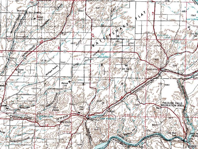
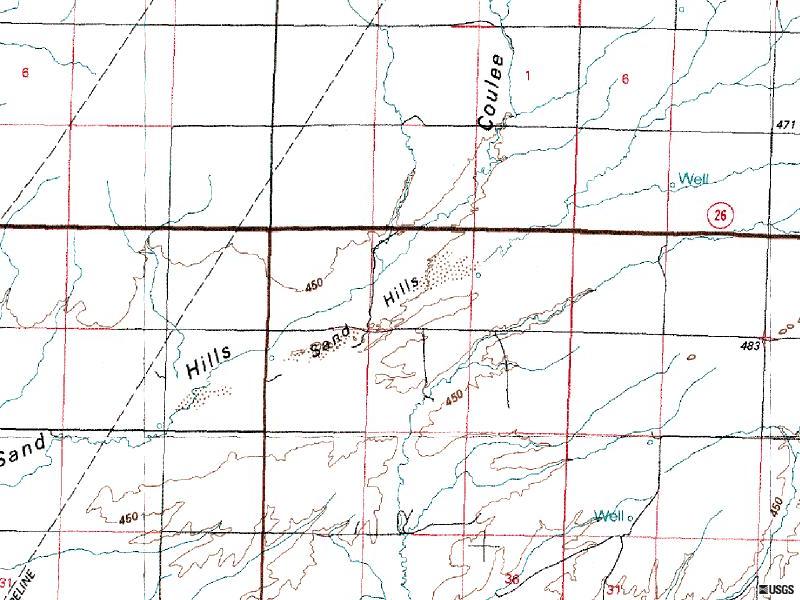
Sand Hills Coulee, Adams County, Washington, USA
This month's article is about a recent survey of dry lakes in the state of Washington and the potential for meteorite-recovery in and between sand dunes.....
.....actually, there are no "dry lakes" in Washington that would be suitable for a meteorite-recovery effort.
The few localities in Washington that are mapped as "dry lakes" are either regularly inundated with fresh sediment or are floored with vegetation, as is the case with the locality described here in this article.
But, there are "sand hills" at this locality. And between these sand hills there are deflation surfaces!
What exactly are "sand hills"?
sandhills - A region of semi-stabilized sand dunes or sandy hills, either covered with vegetation or bare, as in north-central Nebraska and the midlands of the Carolinas.
(From: National Soil Survey Handbook - NSSH Part 629 - Glossary, S-Z)
How were the "sand hills" of Washington formed?
"During the Pliocene and the Pleistocene, gravel, sand, silt, and clay were deposited in lakes or by aggrading streams and rivers in depressions such as the Pasco Basin, where 1,000 feet of sediment lies on top of the basalt. Glacial outwash during the Pleistocene produced huge volumes of wind-blown silt called loess. It blankets much of the Columbia Basin and in places is up to 200 feet thick. The loess-rich soils of the Palouse subprovince provide ideal conditions for growing wheat, making southeast Washington one of the major grain-producing regions of the world."
(From: www.dnr.wa.gov/geology/columbia.htm)
Although loess is very fine-grained silt and can be widely spread by the wind, the coarser-grained silt and sand cannot be carried as far. Typically, the wind will "drop" these coarser-grained, suspended sand particles much sooner, as is the case here in the Sand Hills Coulee. The Coulee (which is a drainage basin) acts as a topographic trap to eolian sand particles.
What does all of this [sand] have to do with meteorites?
Usually sand hills are "semi-stabilized", which allows vegetation to take root, as is the case here at the Sand Hills. This has, in effect, preserved the original Holocene sand dune sediment from eroding away. But under certain conditions, the wind has remobilized the sand and some of the hills have turned back into active dunes. This has occurred locally where the wind has gained strength by being channeled between a set of sand hills. The base of these sand hills becomes scoured by the wind, exposing the long-ago buried sediments into yardang-like outcrops. And between these outcrops is a deflated surface littered with a "lag gravel" of debris - both man-made and natural. The natural debris is comprised of rootlets from the local vegetation, as well as, rock erratics. The man-made debris, comprising of metal parts, such as washers and wheel lug nuts, is a surprise to be seen sitting right on the surface, since it would be expected that these dense objects would sink back into the sand!?
Their presence gives confidence that long-buried meteorites could be similarly exposed!
No meteorites were recovered by our team at this locality (but one MAY HAVE BEEN FOUND by the person who drove the ATV, which made the tracks in the sand as seen in our images, just DAYS before our visit!). Yet, if enough of these kinds of surfaces can be searched, it is very likely that a meteorite would eventually be recovered.
Images from our 2004 August 1st field trip:

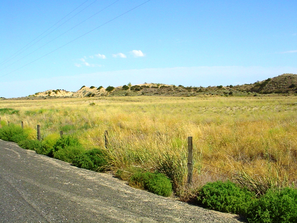
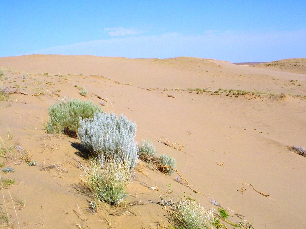
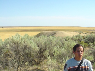
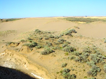
The Sand Hills, as seen from the paved road, are nestled among native-Washington chaparral plants that thrive in the Sand Hills Coulee.
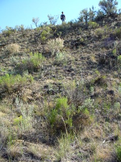
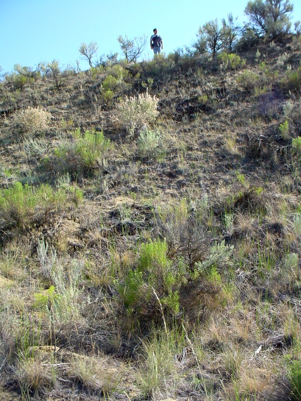
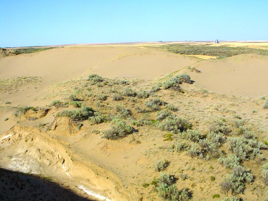
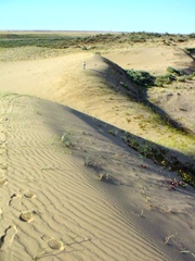
The Sand Hills are actually semi-stabilized sand dunes. The steep slope of this hill is the leeward side of a sand dune that is being held in place by a variety of wild plants.
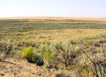
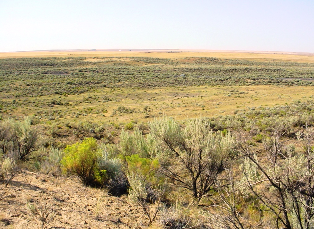
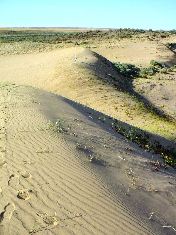
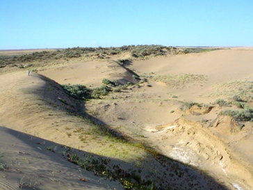
Panoramic view from the top of one of the dunes/hills, showing how they are nestled in a coulee in the middle of wheat covered prairie.
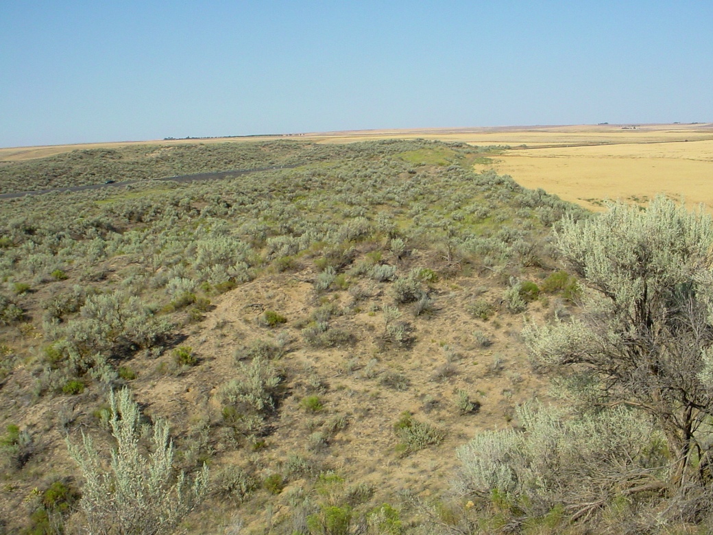
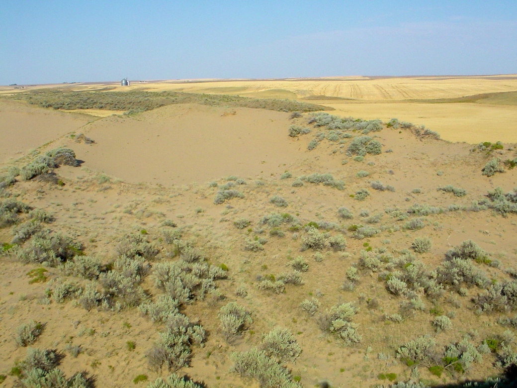
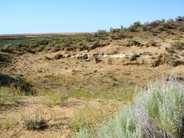
The image on the left is a view of the "dry lake" which appears on some maps, but is clearly covered in chaparral.
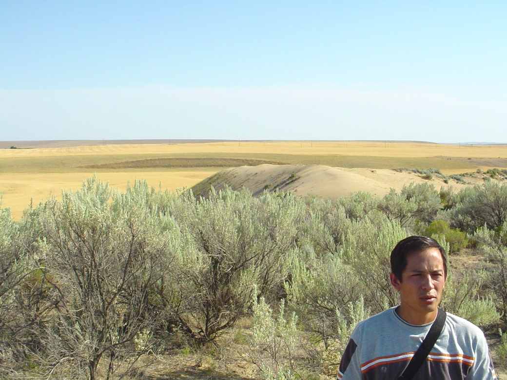
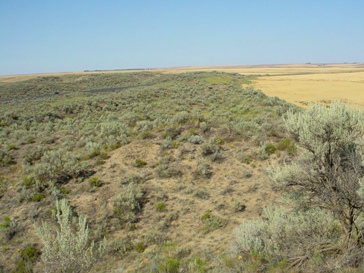
James LaBarbera, the son of Gerry LaBarbera, looking northward from the top of one of the sand hills, stares intently at the "dry lake". Behind him stands a bare hill that has remobilized into a semi-active sand dune.
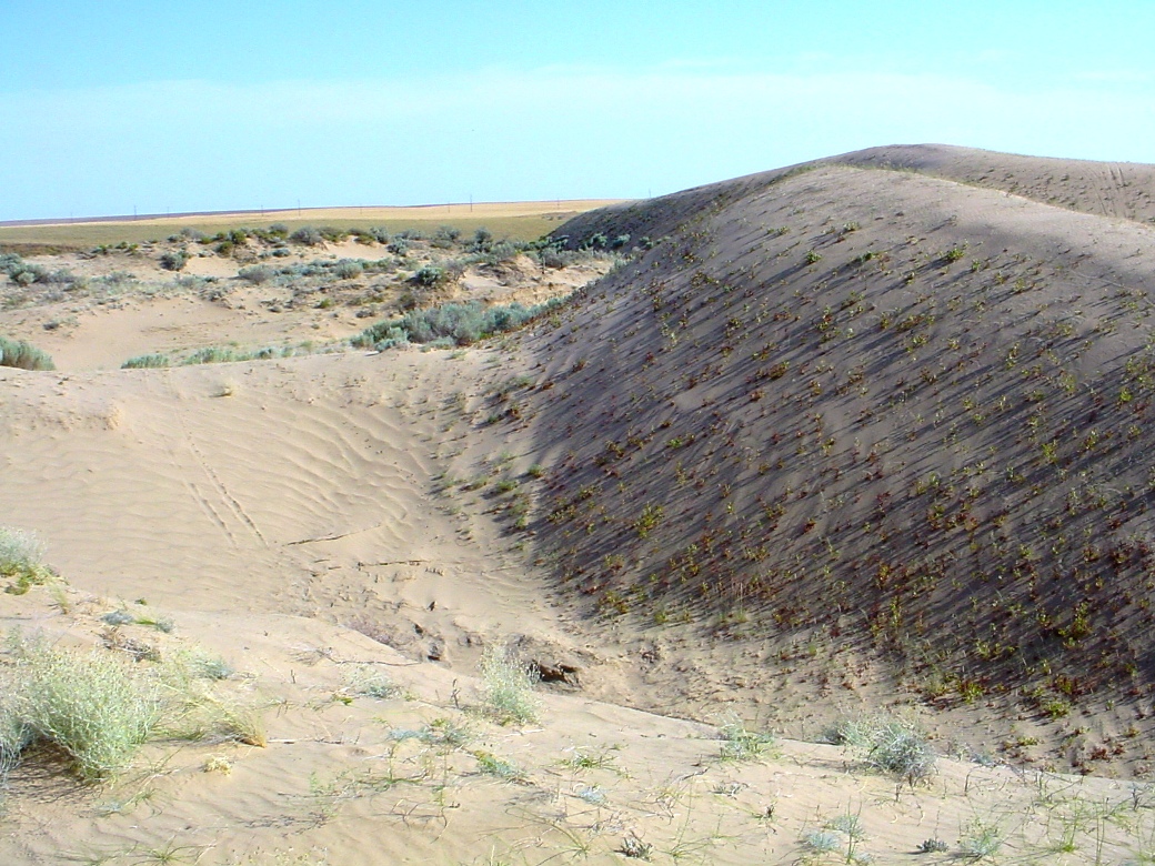
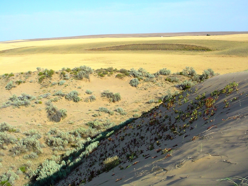
The base of these sand hills becomes scoured by the wind, exposing the long-ago buried sediments into yardang-like outcrops.
The layer of white sediment is not salt. It is volcanic ash! Some researchers call this tephra a paleosol. Other geologists call this layer a time marker. All agree that the age of this deposit is ~13,000 BP.


The above image shows the spot where the wind was channeled between two sand dunes, and where it had scoured away the sand leaving behind a lag gravel of small stones and metal parts sitting right on the surface. Given the age of these sand dune deposits, any one of those small stones could just as easily have been a meteorite.
The above image shows another yardang-like outcrop exposing a layer of white volcanic ash. This ash deposit has been age-dated to be coeval with either the Glacier Peak eruption of ~13,000 years ago, or as old as the Mt. St. Helens eruption of ~15,400 years ago. At the base of this outcrop was a scattering of rocks and other dense debris that had accumulated as a "lag gravel" as the layers of sand eroded away. If enough of these deflated surfaces could be search, it would only be a matter of time until a meteorite could be recovered.


In a state with so few dry lakes and so many sand dunes (particularly "sand hills" underlain by late Pleistocene eolian deposits), the best chance for recovering a meteorite in the state of Washington would be by conducting a systematic search of this particular kind of deflation surface.
References related to the Sand Hills of Washington:
Abstract about "Dust and Northwest Geology" -
Where did all of this "dust" come from!
Sand Hills Coulee, Adams County, Washington -
Understanding the Geologic Input of Dust into the Atmosphere of the Columbia Plateau
The Geology of Washington - Columbia Basin
Juniper Dunes, Franklin County, Washington -
Yahoo! Search Results for The Juniper Dunes Pasco Washington
OTHER References related to "Sand Hills":
Here are images of the Sand Hills of Nebraska:
Nebraska-Sandhills-Aug2001
... Photographic Tour of the Sandhills Region. of Nebraska, August 12, 2001 ... A Photographic Tour of the Nebraska National Forest ... UNL. University of Nebraska-Lincoln. High Plains Regional ...
DOE Document - Dune-dammed lakes of the Nebraska Sand Hills: Geologic setting and paleoclimatic implications
Within the western half of this grass-stabilized dunefield, about 1,000 interdune lakes are grouped into two clusters here named the Blue and Birdwood lake basins.^In the lake basins, those parts ... dunes were active in the eastern Sand Hills in Late Holocene time.^With the onset of an arid ...
The topic of my next few articles will continue a series on various Meteorite-Recovery Teams.
My previous articles can be found *HERE*
For for more information, please contact me by email:
Bolide*chaser