An Article In Meteorite-Times Magazine
by Robert Verish
![]()
An Article In Meteorite-Times Magazine
by Robert Verish
Drylakes and Examples of "Transported Rocks"
- Geologic Processes that can Accumulate Meteorites on Stranding Surfaces -
Among those of us who actively search dry lakes for meteorites, a general consensus has developed over the years. This formed "conventional wisdom" is that dry lakes are much more dynamic than one would expect. Specifically, that the lakebeds are active geomorphic surfaces, not only over geologic time, but from season to season. This has resulted in an appreciation for the role of stranding surfaces in the accumulation of meteorites. A corollary to this is the regrettable acceptance that no useful strewn field data can be ascertained from the pattern of finds made upon these same geologically "active" dry lakebeds.
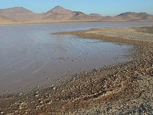
Image Info: taken on 1999 September 7th by Robert Verish.
Goldstone Dry Lake is depicted in the above image. It is located in the Mojave Desert north of Barstow California at the Goldstone Deep Space Network tracking station which is on the Fort Irwin National Training Center. While employed as a contractor for JPL, I would on occasion travel by various dry lakes on my way to the NASA tracking station. Since 1984, I've had the opportunity to observe the interaction of water and wind on these lakebed surfaces.
Image Info: taken on 2004 October 29th by Robert Verish.
Rogers Dry Lake is depicted in the above image. Traveling by airplane to the NASA tracking station would afford interesting and unique views of Mojave Desert dry lakes. This image was taken shortly after a large storm swept across southern California, affording me the opportunity to observe how water from storm runoff would flow over this lakebed surface.
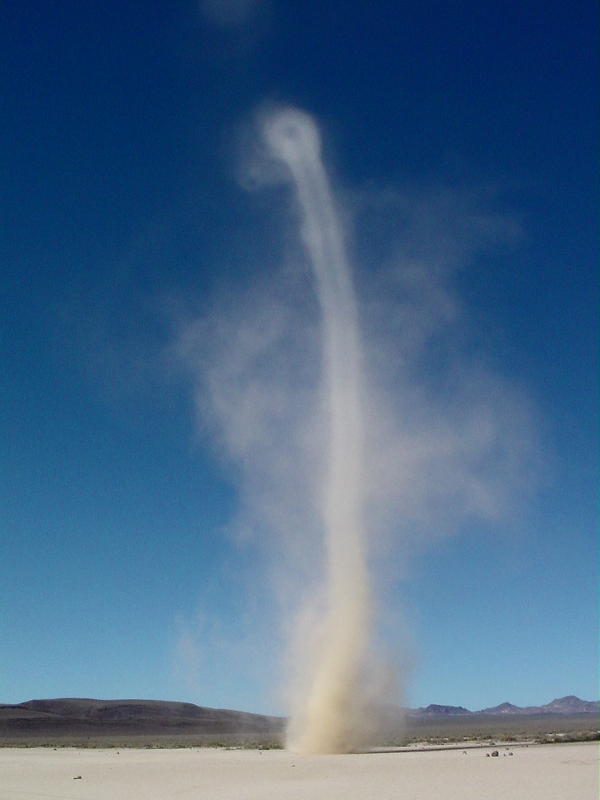
Image Info: taken on 2004 June 9th by Robert Verish.
A "dust devil" scurrying across Ralston Flat Nevada is depicted in the above image. Although dry lakebeds give the appearance of being very static surfaces, runoff from intermittent storms will bring sediment into these basins. While dry, mud flats and playas such as this one will lose sediment over time through a process called "deflation". If the net result is a lose of sediment, then a playas surface is essentially a large "blowout", which is a condition which favors the exhumation of meteorites. Deflation is a process that can result in an accumulation of rock upon the surface of a dry lake. But if this process only involves the wind removing fine, dry sediment, then this is only rock accumulating in a vertical sense. When rock accumulates in a horizontal manner (laterally), through a process involving wind AND water (or ice) - by wave action or ice-rafting - then the greater the area that can be accumulated, the better the odds that a meteorite can be included in this accumulation.
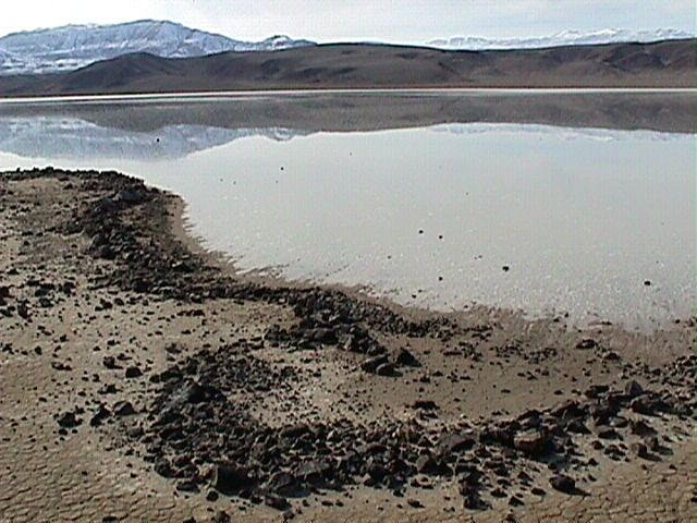

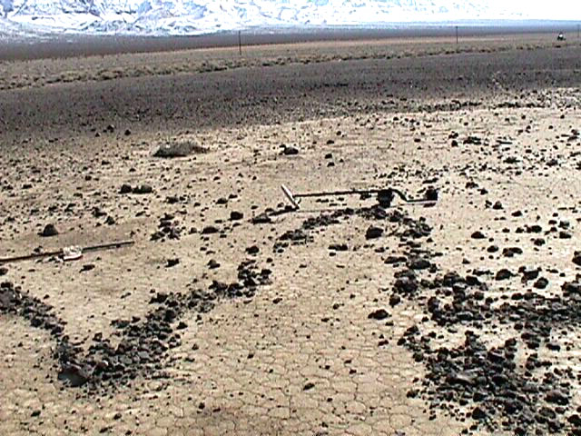
Image Info: taken on 2001 Feb 17th by Robert Verish.
On my first visit to Bonnie Claire Dry Lake wintertime conditions were encountered and there was water on the lakebed. By the time of day that I arrived nearly all of the ice had melted. But there was ample evidence that during the previous night the water had frozen into a sheet of ice. And as recent as that very morning, before wave action commenced, there was fresh evidence that these "sheets of ice" had drifted up onto the shoreline and had produced curious linear alignments of gravel, as if they had been bulldozed by a very large push broom. In fact, there were cobbles, still underwater, with fresh gouge marks in the mud trailing behind them, suggesting that these rocks had been dragged along by the drifting ice sheets.
This locality appears in the Nevada Meteorite Picture of the Day under the "2003 Archives" section.
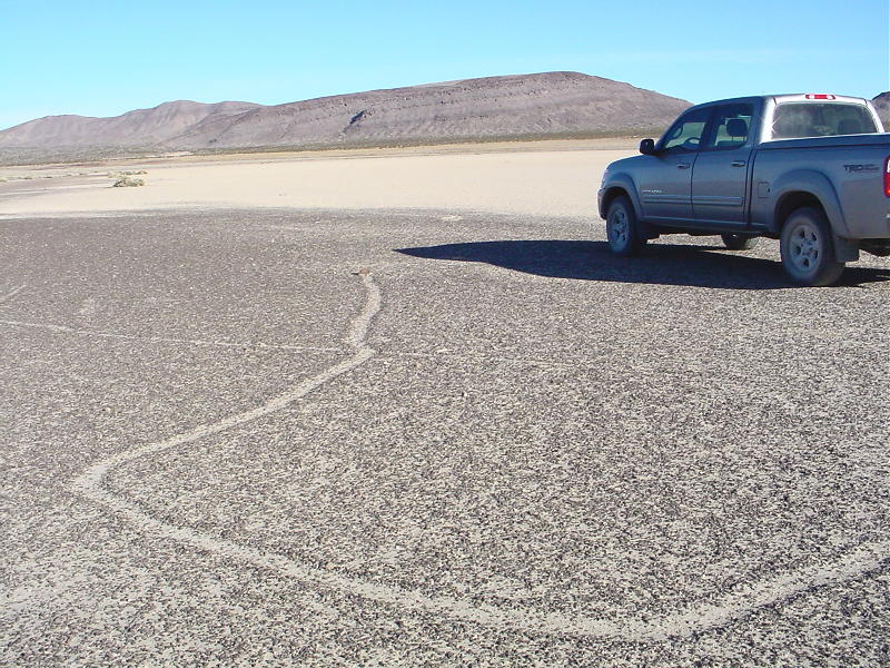
Image Info: taken on 2005 Dec. 29th by Robert Verish.
On a subsequent trip to Bonnie Claire Dry Lake there was still ample evidence of dragged/sliding rocks. Here in the above image is depicted the trail of a cobble that has been dragged through a shoreline of previously accumulated fine-pebbles.

Image Info: taken on 2005 Dec. 29th by Robert Verish.
Here is that same cobble viewed from the opposite direction. Although the "trail" of these drag marks produced by these cobbles appear to zig-zag chaotically, the net result over time is for these rocks to eventually accumulate on a stranding surface, typically the shoreline.
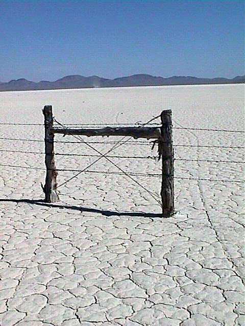
Image Info: taken on 2001 May 29th by Robert Verish.
Mud Dry Lake Nevada circa 2001 is depicted in the above image. Depicted are a couple of rocks that have "slid" under a barbed-wire fence out in the middle of this dry lake. I have no adequate explanation for how this happened, so this still remains as potentially negative evidence for ice-rafted rocks
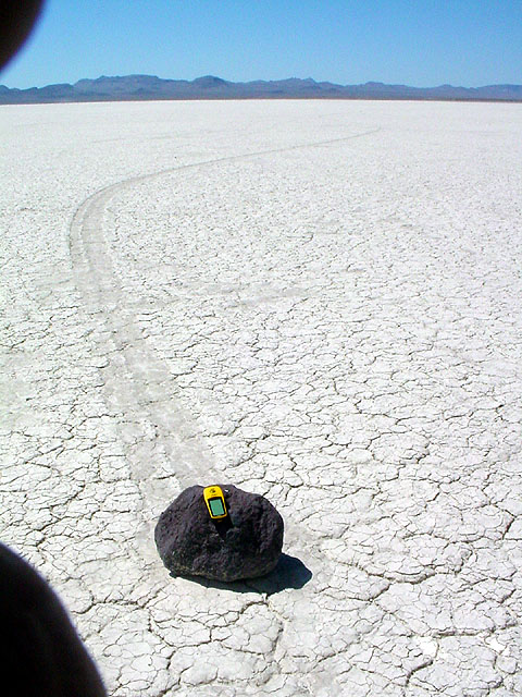
Image Info: taken on 2002 June 15th by Robert Verish.
On a subsequent trip in 2002 to Mud Dry Lake we found even more evidence of sliding rocks. Large rocks!
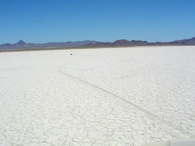
Image Info: taken on 2002 June 15th by Robert Verish.
Most rafted/sliding rocks appear to have originated from the NW corner of the lake. This is the predominant wind direction during the winter months.

Image Info: taken on 2005 June 11th by Robert Verish.
Gravel at the north end of Mud Dry Lake has accumulated into gravel bars in the shape of small, round islands.
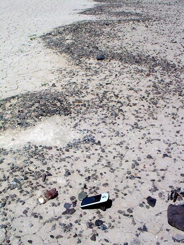
Image Info: taken on 2005 June 11th by Robert Verish.
Compare this uneven shoreline to the "scalloped" shoreline at Bonnie Claire Dry Lake depicted in the previous image.
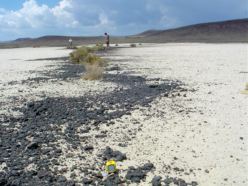
Image Info: taken on 2003 August 16th by Robert Verish.
The Lunar Dry Lake (L4) meteorite - still in-situ at its find locality on a "gravel bar".
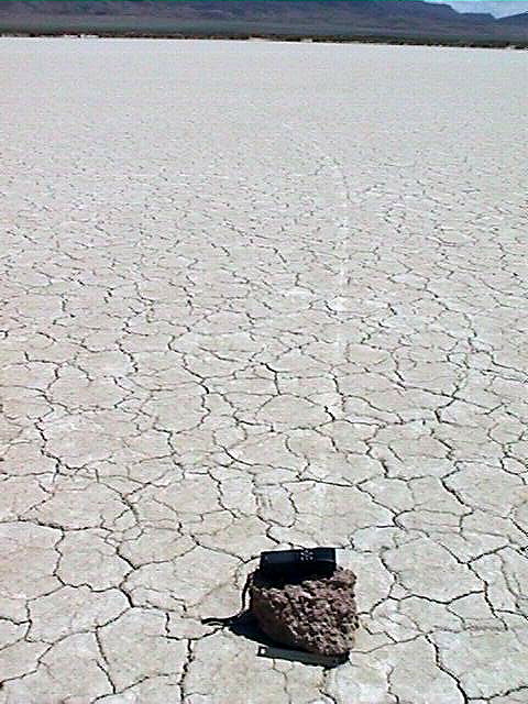
Image Info: taken on 2001 May 28th by Robert Verish.
Out in the middle of an unnamed dry lake in Edward Creek Valley Nevada, I find a small boulder (waypoint: Rock#2) with obvious drag marks preserved in the now hardened silt, suggesting that the direction of travel from where this boulder originated was from the NNE.
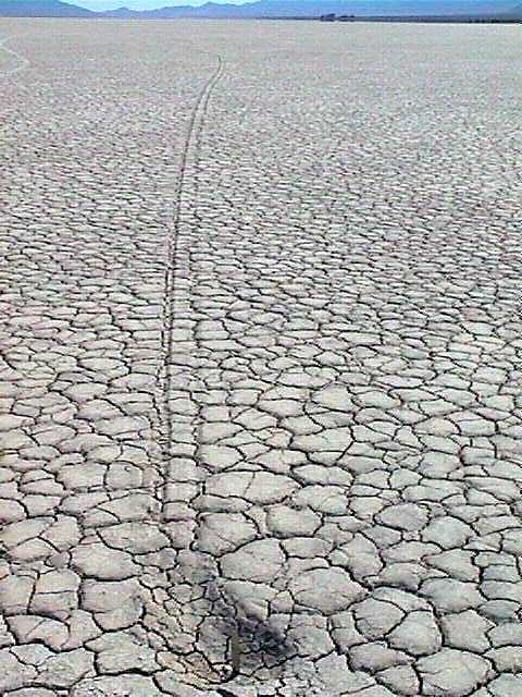
Image Info: taken on 2001 May 28th by Robert Verish.
After following the Rock#2 "drag mark" for nearly a half mile, I find a pit where the boulder was pluck out of the soft mud by the rising lake level while the boulder was still frozen to the surface sheet of ice. Note the 6 inch ruler for scale.
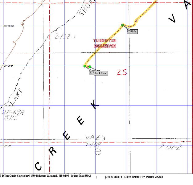
Image Info: taken on 2001 May 28th by Robert Verish.
Map of my GPS tracklog file showing length of Rock#2 "drag mark". As displayed here, it is almost 2000 feet long!
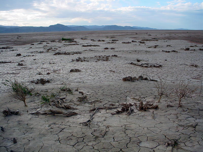
Image Info: taken on 2005 April 22nd by Robert Verish.
Red [Dry] Lake Arizona is depicted in the above image. I have visited this playa a number of times over a five year period, but my April 2005 visit was shortly after a severe winter storm. It had produced the most change to the south shoreline of that dry lake over that period of time. Prior to that storm the vegetation along this shoreline was robust, but as depicted in the above image, all the chaparrel is severely mangled or sheared-off, suggesting that strong northerly winds generated wave action or rammed a massive sheet of ice up onto this shore.
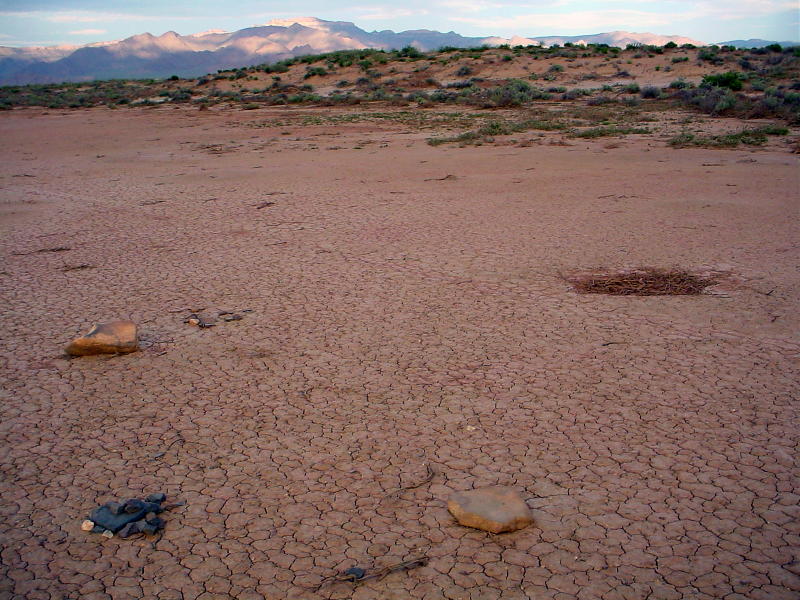
Image Info: taken on 2005 April 22nd by Robert Verish.
This image is taken in the opposite direction from the previous image. A wind-driven surge of water has come on-shore and has coated everything with a reddish-colored clay, hence, the name Red [Dry] Lake. The two boulders in the foreground are monuments where small, individual chondritic stones were recovered on an earlier visit. Originally, there were more monuments placed at this location, but those piles of small rocks have long since been dispersed by wave action. The pile of fresh, uncoated rocks in the left foreground marks the spot of a just found, small, but whole individual chondrite. This new find gave every indication of having been recently exhumed and was still partially buried. I base this contention on the nearby presence of a small, circular subsidence feature (a hole) that developed during the water's high-stand. The image shows it to be filled with driftwood, but as this "hole" drained away the water, it drew down a lot of the nearby silt, and in the process partially exhumed the new find.
Between the time that I made my initial finds, and my finding this new stone, there were some other people that made finds at this same spot!!
Whether my new find was just recently washed up onto the shore, or was recently exhumed, it is highly unlikely that it was on the surface when all the earlier finds were made. Most likely, none of the later finds were on the surface, or in the vicinity of this location, when any of the earlier finds were being made.
Key word is "whole", not fragments. The point is, there have been an unusually large number of whole stonys recovered at this location. Albeit, they have been found over a period of time, but all of them have been found on just this short portion of a long stranding surface. This is what I would call a "dense accumulation".
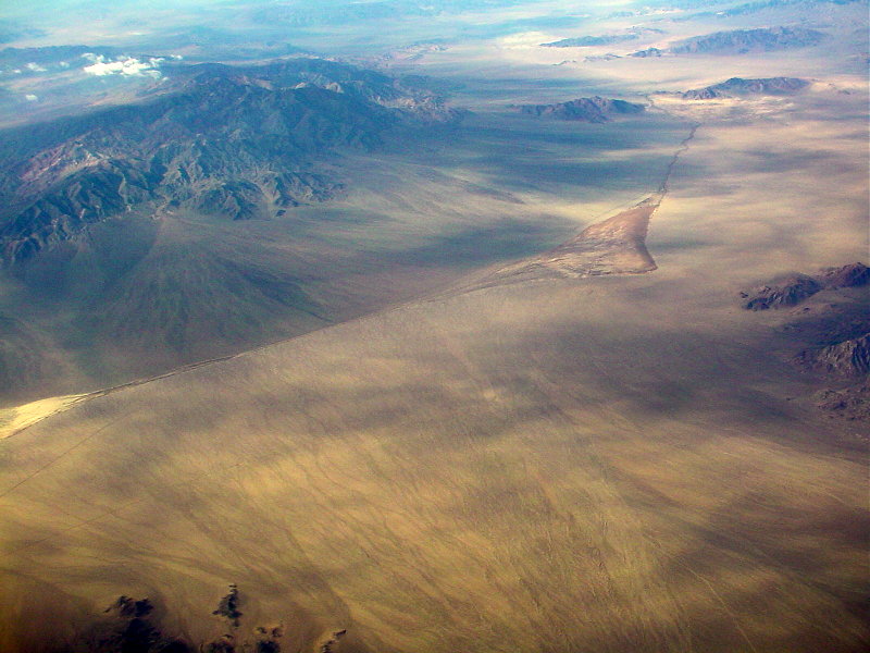
Image Info: taken on 2004 October 29th by Robert Verish.
Sediment flows out onto Silurian Dry Lake from the south, but this same flow drains away sediment from a small, unnamed mud flat (left side in the above image).
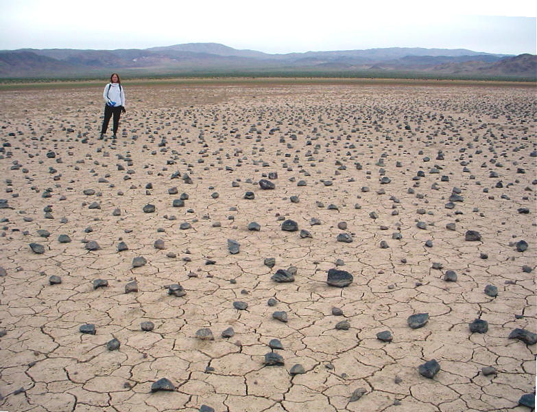
Image Info: taken on 2006 January 1st by Robert Verish.
Note in the above image that all of the rock on this dry lake are equal-distance-spaced apart. Nearly the entire surface of this mud flat was littered with this unusal scattering of basaltic detritus. With the exception of only a few small clusters of cobbles around a random boulder, the rocks on this mud flat failed to accumulate into gravel bars or onto any of the shorelines. Without the benefit of any sort of accumulation, it came as no surprise that no find was made on this dry lake.
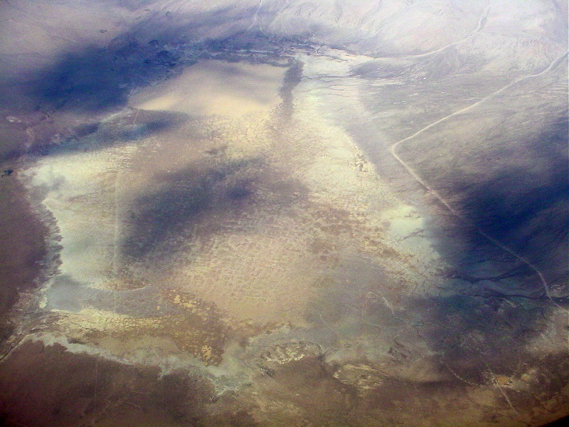
Image Info: taken on 2004 October 29th by Robert Verish.
Sediment flows out onto Coyote Dry Lake from various alluvial fans. Standing water has initiated the formation of "giant polygonal desiccation cracks" which in turn has drained away most of the water (except at north end of lake - top of image) and in the process has drawn off the top layer of clay/silt from the lakebed. The repeating of this cycle has over time produced a superbly deflated basin.
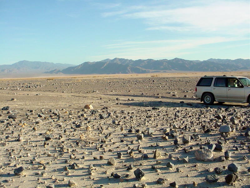
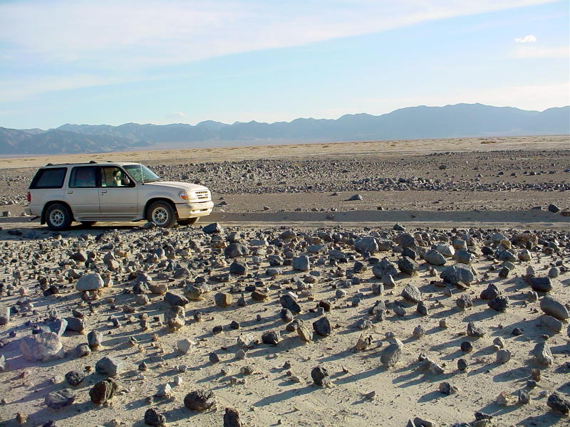
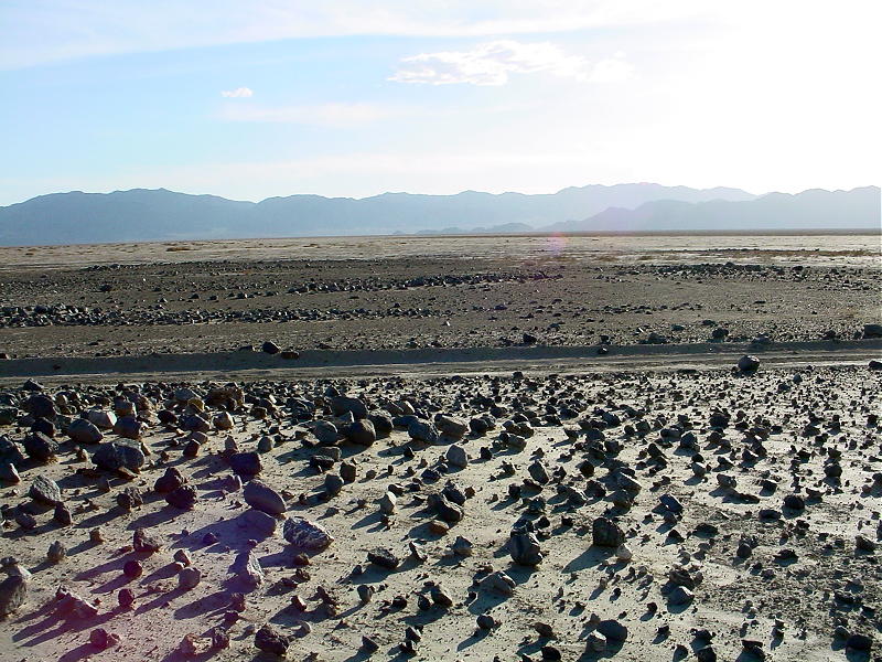
Image Info: taken on 2002 May 19th by Robert Verish.
Panorama of a Dry Lake in Nevada. Note - in the above image that all of the rock on this shoreline are a type of "lag gravel". Wind and wave action on this shoreline have removed the finer sediments leaving behind a "rock garden" of large cobbles and small boulders. One explanation for this unusal formation to occur is that there must have been as strong flood of mud and detritus flowing down the alluvial fan in order for clasts of this size to carry this far out onto the valley floor.
Unusal occurrances of rocks on dry lakes are continually encountered. The natural processes that move these rocks out, onto, and around on these dry lakes are varied. These same processes effect the movement and accumulation of meteorites upon these surfaces. Close attention to these processes and a better understanding of how stranding surfaces form will result in a more successful effort at meteorite recovery.
For more information, please contact me by email: Bolide*chaser
REFERENCES:
| Web | Results 1 - 10 of about 168 for verish |
[PDF] 65th Annual Meteoritical Society Meeting (2002) 5263.pdf
| File Format: PDF/Adobe Acrobat - View as HTML IMPLICATIONS OF ICE RAFTING FOR METEORITE. RECOVERY ON SEASONALLY WET PLAYAS. N. Gessler. 1. ,. P. Gessler. 2. , RD Matson. 3. and RS Verish ... www.lpi.usra.edu/meetings/metsoc2002/pdf/5263.pdf - |
[PDF] 65th Annual Meteoritical Society Meeting (2002) 5295.pdf
File Format: PDF/Adobe Acrobat - View as HTML
METEORITE RECOVERY ON DRY LAKES – FOLLOW. THE ICE-RAFTS. RS Verish. 1. ,. 1. Meteorite Recovery Foundation,. PO Box 713009, Santee, CA 92071. ...
www.lpi.usra.edu/meetings/metsoc2002/pdf/5295.pdf -Similar pages
[ More results from www.lpi.usra.edu ]
Nevada Meteorite Picture of the Day
| Over geologic-time, the energy coupling wind with water (waves & ice-rafts) would
eventually transport the meteorites on these dry lakes to the shorelines. ... https://meteorite-recovery.tripod.com/nvmetpod/03-07-14.htm - 7k - |
Racetrack Playa
Death Valley
Image Info: taken in 1991 Greenland by fvalk @ fvalk dot com
My previous articles can be found *HERE*
For more information, please contact me by email:
Bolide*chaser
![]()