![]()
The Whitmire (South Carolina) Bolide of February 13th 2012
The search for meteorites from this fireball-meteor still continues.
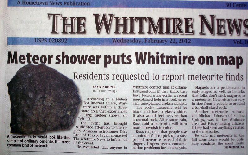
Meteor makes headlines in The Whitmire News!
(Wasn't really a "meteor shower", but hopefully, it was a meteorite shower;-)
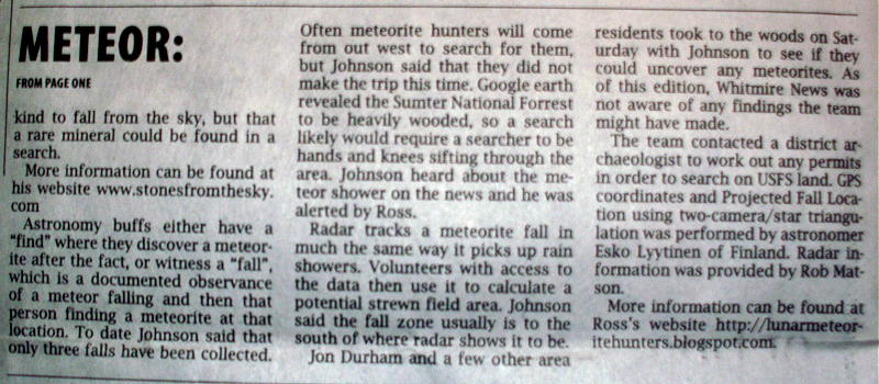
Continuation of front-page article on page 2.
(Actually, this was a better than average news article, compared to other "meteor" articles that I've read in much larger newspapers.)
Another title to this article could be - "How I Spent My Spring Vacation".
But this is not a picture "slideshow" of my week long stay in South Carolina last month.
This is more of an effort to draw attention to a special celestial event that occurred over the town of Whitmire, South Carolina in the early morning hours of 2012 February 13th (01:42 am EST / 06:42:47.831 UTC).
This "celestial event", that I speak of, was the passing of a very bright meteor, or fireball, that was witnessed by many as it fell in an arc across the night sky, and then was followed by a rumbling sonic boom (which makes this fireball a "bolide").
It is my hope, that by writing this article, more people will take an interest in this "meteor" event and try to find the meteorite(s) that fell from this bolide, while it is still freshly fallen. I realize that to the lay person this will be "like looking for a needle in a haystack", but look folks, at least now we know where the "haystack" is located! We have confirmed NOAA Doppler Radar that shows the debris falling from this bolide. This article is a timely attempt to convey that data, as well as, an attempt to convince the reader that, contrary to popular wisdom, it IS possible to search and find even a small meteorite in a pine forest.
First, allow me to state the obvious: I did not find any meteorites during my visit to South Carolina.
But it was not for lack of good areas that I could search. The fact of the matter is, there were too many good areas to search. I hadn't given myself enough time. I feel that I needed to give myself, at least, 2 to 5 more days of searching. (After all, it took me all of 11 days to find my first and only Mifflin meteorite, and I was in the strewn-field the whole time!)
So, it's not a matter of me asking others to do what I couldn't do. It's more a matter of me letting enough people know that if they continue what I have started, it will only be a matter of time until a meteorite is found.
Second, I will not be going into detail as to what were all of the reasons that convinced me there are meteorites on the ground in Whitmire and that prompted me to pick-up my bags and fly to South Carolina, so if you are interested in those kind of technical details, you would be best served to go directly to my "REFERENCES" section at the end of this article.
As an aside (and hopefully this doesn't become a major distraction to my main objective - "getting people interested in looking for this meteorite"), this article will also serve as a "wake-up call" to the US meteorite-reseach community, that US meteorite falls are going unrecovered due to federal policies that need to be changed. Statutes that have been put in place to protect and preserve legitimate artifacts are obstucting the recovery of freshly-fallen meteorites. It is the contention of this writer that a meteorite from this fall would have already been recovered by now, except that the professional meteorite dealers/hunters (typically, one and the same) have been totally absent from this recovery effort. The reason being is that the majority of the area under this meteor's Doppler radar pattern (the predicted fall location) is public lands and there is no system in place to compensate these professional hunters should they find a meteorite. In fact, it's not permissible to pick it up, let alone keep it.
And another fact, there was another meteorite fall in Saskatchewan, shortly after this Whitmire fall, which completely drew away attention from Whitmire, as all the big meteorite dealers started packing for Canada. But what this means is that these "professional hunters" would rather go out of the U.S. and go to Canada (where they know their recovery efforts would be compensated), even though there were more risks and having to endure frigid mid-winter conditions.
Simply put, the U.S. meteorite-researchers are losing out to the Canadians, who had the forsight to CHANGE their POLICIES (I repeat, NOT their laws, but how those laws are administered), and who are now seeing a four-fold increase in the recovery of Canadian meteorite falls.
This is what I define as a "wake-up-call".
Now, let's get back to my story.
As soon as I arrived in Whitmire, I felt that luck was going my way when I stopped at the mini-mart to get drinks, and there in the newspaper stand was a tall stack of freshly delivered Whitmire News papers - with the very prominent headline: "Meteor shower puts Whitmire on map"!
I immediately bought up a couple dozen, and along with my pre-printed flyer and card, I handed-out these complimentary newspapers to all of the private property owners who lived in the vicinity of the "NOAA Doppler radar reflections" (which is essentially, all of the residents along Jalapa Road). I felt there was nothing more to be gained by interviewing eye-witnesses, (after all, I already had the Doppler radar reflections) so I went straight to work at doing what is my forte, searching for and finding small meteorites.
By the way, regarding the newspaper article that appeared in the Whitmire News (see the above image), our colleague Dirk Ross and his website is mentioned several times.
Finding "private property owners", meeting and talking with them, and getting their permission to search their property was much more time consuming than I had anticipated. My percentage of success at getting permission was about 50%. Some of the owners that declined permission expressed an understandable interest to search their property, themselves. Or they wanted me "to be accompanied in the search by their [adult] son". All of these owners thanked me for bringing their attention to this bolide, and seemed to be genuinely sincere in wanting to contact me should they find anything in the future.
One of the property owners had an interesting reason why she didn't give me permission. She said that "it had already been hunted by two other people"!
The two people that she was referring to were: Michael Johnson from Boiling Springs, SC, and Stuart McDaniel of Lawndale, NC, who's All-Sky Camera caught this fireball-meteor on video which made it possible for other researchers to calculate where this bolide fell, which made it possible to find the Doppler radar reflections, and which ultimately brought me here to Whitmire, SC.
So, a major tip-of-the-hat to Stuart! Kudos for him.
If you, too, would like to visit Whitmire and to lend some help to recovering this meteorite, you don't have to "re-invent the wheel" or start-all-over-again, as I did (such as contacting property owners, etc). Since I have returned from my trip there have been a number of people local to Whitmire who have come forward and expressed interest in conducting and leading "group searches". (I'll list their names and email addresses below.)
My colleague, Dr. Nick Gessler (from Duke Univ.), continued the recovery effort at Whitmire and is conducting a public outreach program at Greenville and in South Carolina. His efforts have resulted in getting Dr. Barry Morris, the Whitmire Community School science instructor, to volunteer as being the point-of-contact for future "group" recovery efforts on private property, since he is prominent in the community and is already in contact with the local private property owners. "Doc" Morris said that his students are always eager to go out in the field to search for meteorites.
Any "group effort" attempting a meteorite-recovery on public lands will involve prior planning. The Sumter National Forest (NF) Archaeologist, Mike Harmon, is requesting that he be contacted, first.
So, here are the names and email address for the points-of-contacts in Whitmire:
Barry Morris Email: bmorris@newberry.k12.sc.us who is a well-respected Science Teacher at Whitmire Community School
Mike Harmon Email: mharmon@fs.fed.us who is theUSDA Archaeologist at Enoree Ranger Station - Sumter National Forest
Now here are some pictures from my "Spring Vacation":
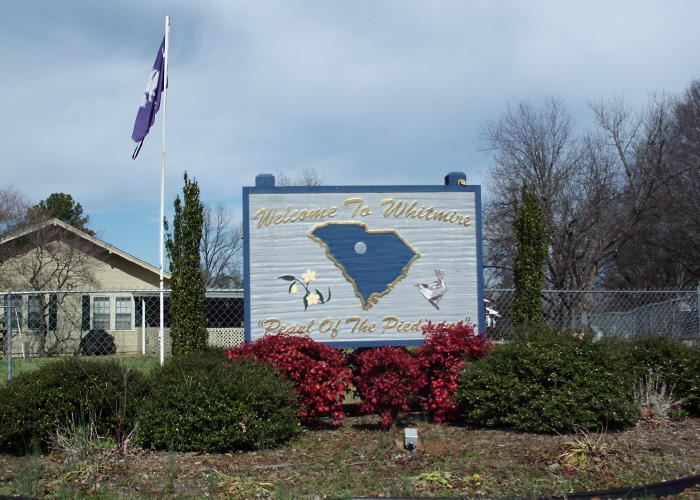
Upon entering the town, you will see a sign that says,
"Welcome to Whitmire - The Pearl of the Piedmont"
(Being a Pittsburgh Steelers fan, I would hasten to add,
"Also the birthplace of Donny Shell")
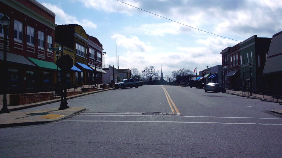
Main-street for Whitmire (in its entirety).
There are 2 small restaurants located here (in this image). The nearest motel is in Newberry (15miles S).
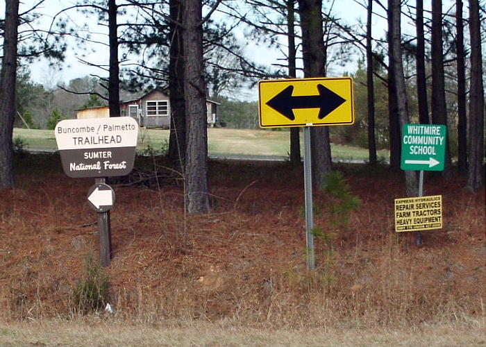
These signs are at the very south-end of town. This is an intersection on SC66 where you can turn SW and hit the Buncombe Trailhead, or turn north towards the Whitmire high school where Dr. Barry Morris is the science teacher, and is the point-of-contact with the local property owners for getting permission to seach private property and for organizing group searches.
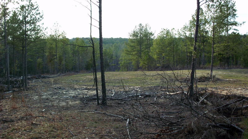
Private property in the predicted fall location offers the best opportunity to search in cleared-out areas.
It is imperative that you contact the property owner prior to hiking in these areas. For assistance
in contacting private property owners, please contact Dr. Barry Morris at the Whitmire Community School.
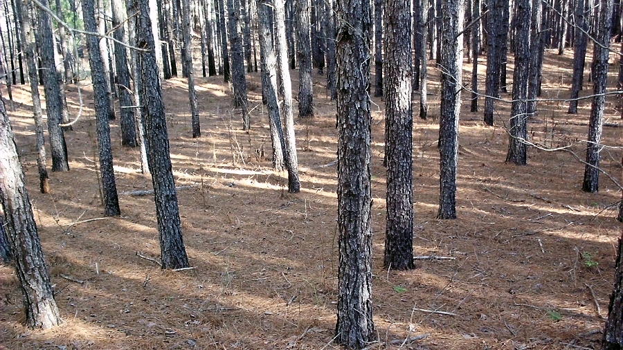
Clearings (cleared-out areas) are not essential for conducting a meteorite-recovery search.
Conifer forests, whether they are on private property or are part of the Sumter NF, offer equally good surfaces for conducting a search.
In fact, a case could be made (for the smaller falling stones, at least) that the branches of the pine trees would afford an opportunity for those stones
to be deflected just enough to keep them from penetrating the ground, and may even bounce back up and sit on top of the pine-needle litter.
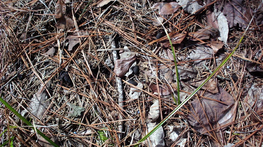
Because of their darker-color, burnt pine-cones and conifer seeds stand-out against the lighter-colored pine-needles and oak-leaf litter on the forest floor.
This suggests that similar-sized, dark-colored stones should also stand-out on the ground in a pine forest.
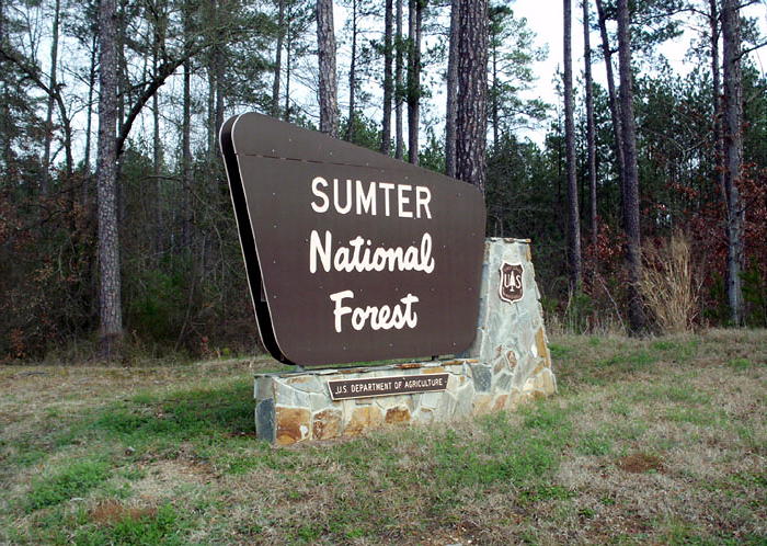
In the predicted fall location, private property is usually surrounded by the Sumter NF, which are public lands that are administered by the U.S. Department of Agriculture (USDA). The National Forests, like Sumter, are multi-use areas, but the general public must give consideration to the contractors and leasors (such as logging companies) that work throughout these public lands. There will be some areas where access will be restricted, but these areas are always very well posted. Nevertheless, there are many designated hiking paths and horse trails that the general public can utilize.
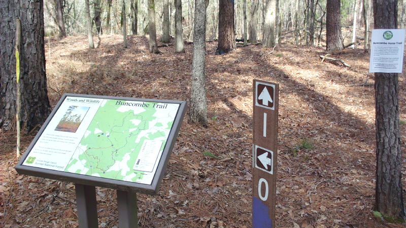
In the Sumter National Forest (NF) there are numerous, well-maintained "horse trails" that can be easily hiked.
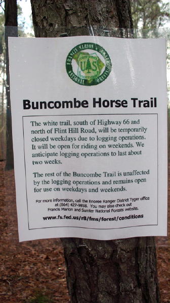
As this sign shows, the only areas in the Sumter NF that have restricted access are those areas where logging are actively being conducted (for obvious reasons).
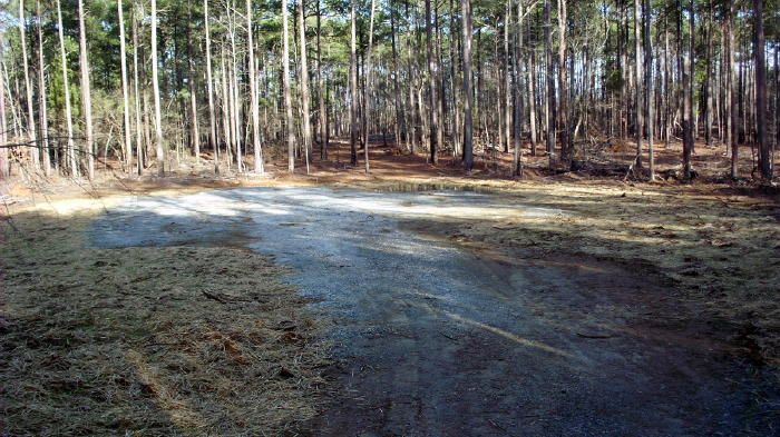
Gravel roads leading to inactive logging areas offer a great deal of "bare" surface for hiking, as well.
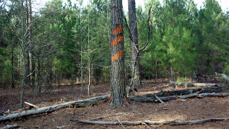
While hiking, if you encounter a tree with markings such as these, above, you have entered an area that has been designated for logging purposes. USDA contractors make these marks on what is called, "boundary trees". This boundary may also indicate that you are exiting public lands (and possibly entering private property).
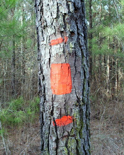
USDA contractors make these marks on "boundary trees" to indicate the boundary of NF with private property.
If you are hiking in the NF and should miss seeing this mark on a "boundary tree", you are very likely to see soon a "private property" posted sign, like the one below.
Please do not enter private property without permission.
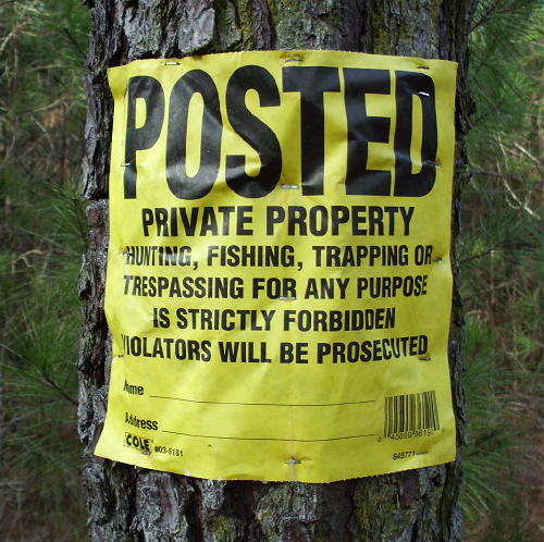
Needs no explanation.
The boundary of the NF with private property is well-posted, particularly if that property is a private "hunting club".
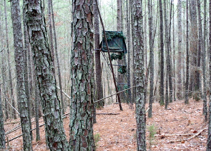
You know you have strayed onto private property, if you encounter one of the above, which I call a hunters "blind".
Actually, this is a portable "blind", and it is not on private property, but was left behind deep in the NF.
But what I'd like to point-out in this image, is how dense the pine forest is, yet you can still see forest-floor easily.
I maintain that these conditions are very favorable for a meteorite-recovery effort:
A dense stand of trees with numerous small branches to deflect a falling stone from penetrating the ground,
and a uniform, light-colored surface (pine-needles) upon which even a small black stone can be easily spotted.
(You have no idea how many animal droppings there are in these woods;-)
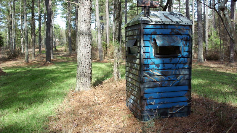
No! This is not a TARDIS!
When you've strayed out of the NF and you encounter this, you've entered private hunting grounds.
When it's hunting season these "blinds" have men with loaded weapons waiting to shoot a deer or turkey.
When you hike into hunting club property without permission you might be considered a turkey.
Don't be a turkey!
(Get rid of cable;-) Get permission before entering private property.
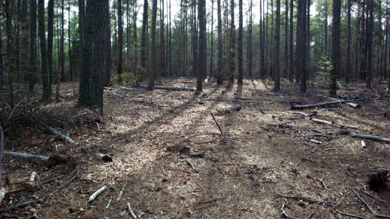
Unfortunately, a lot of wasted wood is left behind after logging operations have ceased. But even though
this litter makes it difficult to spot small black rocks, at least all of the thick undergrowth has been cleared away.
Even in these not-so-optimal-conditions, there is still a chance for a recovery to be made.
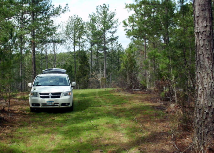
Even now, I still can't get over the fact that for all of the 6 days I spent hiking in these woods, I never once
saw anyone else searching for debris from the February 13th Whitmire Bolide fall.
Were all of the meteorite-recovery experts really intimidated with the prospect of having to search in a dense forest?
Or more likely, were they all discouraged with the prospect of having their meteorite finds (if found on public land) being turned over to
the Smithsonian Institution in Washington, DC?
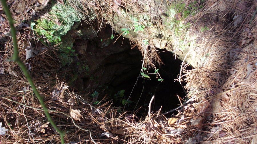
Consider the image above. It depicts what is argueably a 100+ year old well, which makes this an "archaeological site".
Which means that this is protected and should not be disturbed. While hiking in a National Forest,
if a person should encounter one of these (or for that matter, any object of archaeological interest), it should be left untouched.
There are no restrictions in taking pictures, though, and it would be a good idea to take a GPS waypoint.
Hiking and taking pictures in National Forests does not require a "permit".
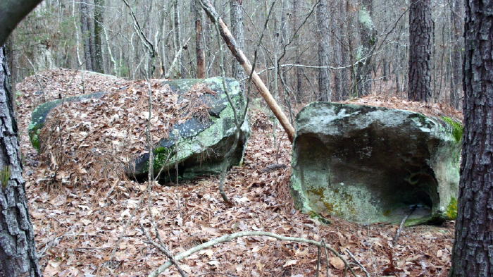
While hiking in the Sumter National Forest, I encountered several rock piles, cairns, caves, and monoliths, which
a prudent person would consider to be of some archaeological value. In some cases I took pictures of them,
as well as GPS waypoints. But I always left them untouched. Hiking and taking pictures in Sumter NF does not require a "permit".
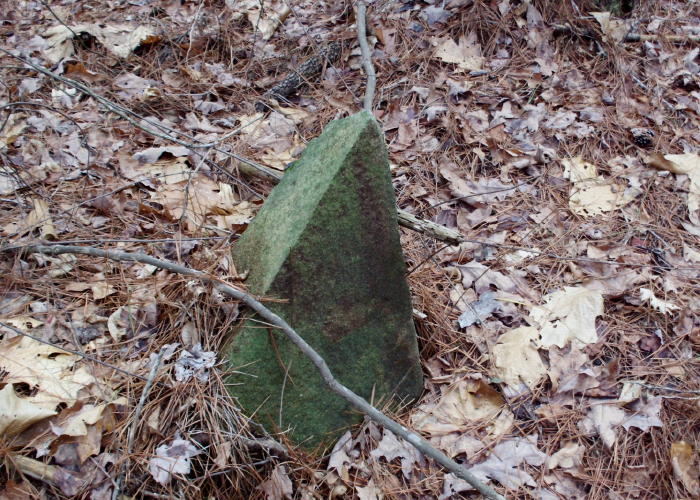
While hiking in the Sumter National Forest, I encountered several rock piles, cairns, caves, and monoliths,
which a prudent person might consider to have some archaeological value.
In some cases I took pictures of them, and usually I took GPS waypoints, as well.
- - - But I always left them untouched. - - -
Hiking and taking pictures in Sumter NF does not require a "permit".
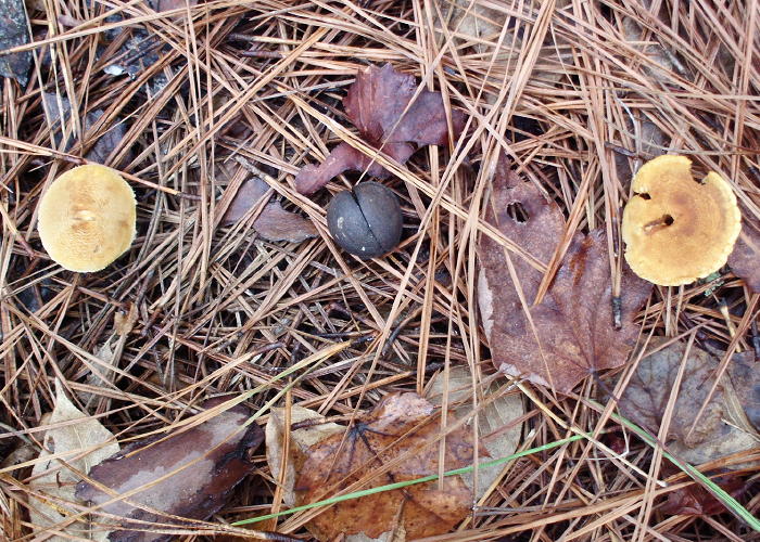
Because of their darker-color, hardwood nuts stand-out against the lighter-colored fungi, pine-needles and oak-leaf litter on the forest floor.
This suggests that similar-sized, dark-colored stones should also stand-out on the ground in a pine forest.
In fact, I would carry a bag of unshelled "hickory nuts" to use as a "throw-down" in order to gauge
my ability to spot a small, round black object in the leaf litter on the ground.
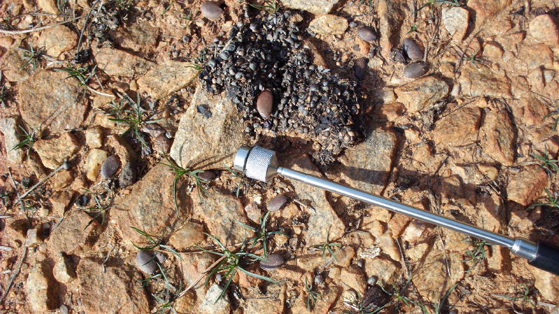
Because of their darker-color, animal droppings stand-out against the lighter-colored duff of the forest floor.
More evidence that similar-sized, dark-colored stones should also stand-out against exposed subsoil in this piedmont area.
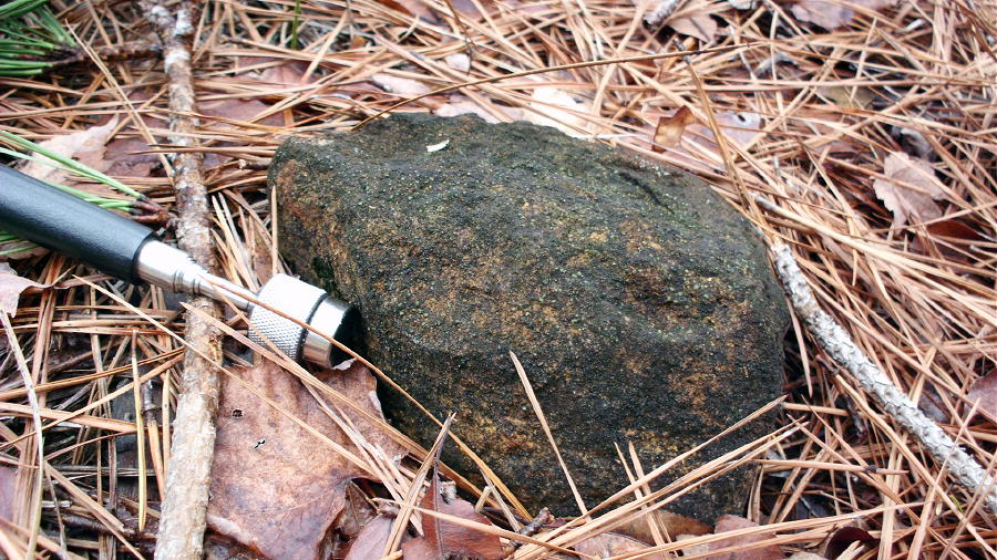
It was very rare to see a rock poking-out from the pine-needle-oakleaf duff. So, when I saw this cobble it caught my attention.
But since it wasn't the right size/shape/color for a freshly fallen meteorite, I walked on by.
Yet it still had that look I've seen in weathered desert meteorites, so I went back to the cobble and placed my magnet stick next to it.
The magnet was attracted to it!
I stood there for a while entertaining the notion of whether this could be an old weathered meteorite, or not,
but then decided to get-on with the task at hand, and continue with the search for a "blacker-fresher" meteorite.
In any case, I had no choice but to leave it behind, because as the current USDA policy stipulates, if it was a meteorite,
it is considered to be an artifact, and must remain untouched.... ! .... So there it still remains.
(And USDA, until you change this policy, please don't bother asking me for the coordinates.
Quid pro quo.)
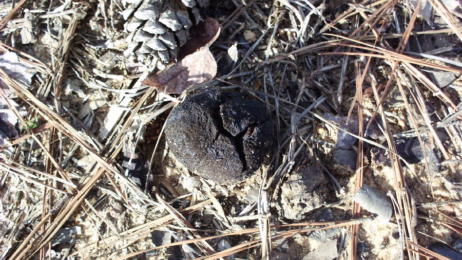
The same applies to this object, as well.
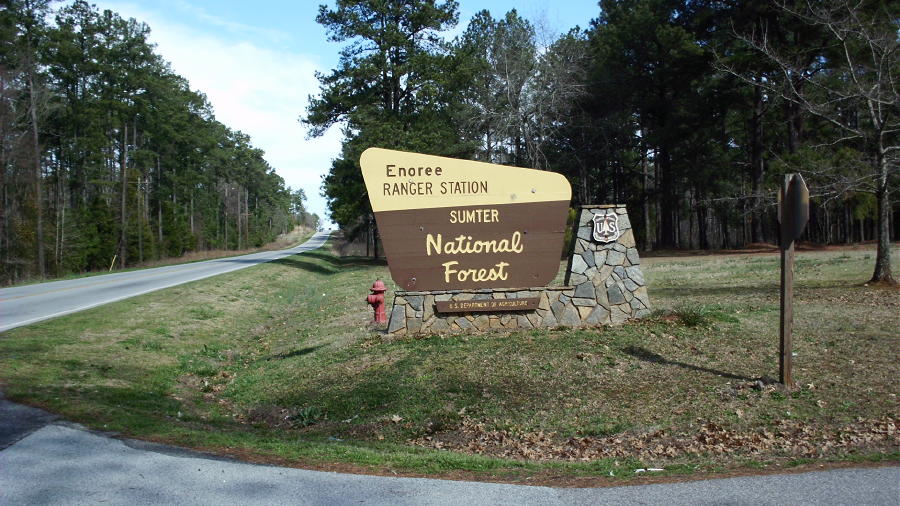
Before departing Whitmire on my return trip going back home, I paid a visit to the Sumter NF Ranger Station.
I gave them my remaining copies of the Whitmire News paper and informed them about the "Meteor" (which they were well-aware of)
and then I shared with them copies of the NOAA Doppler Radar images (which are the following 2 images, below).
I also recommended that the Rangers brief all USDA employess, contractors, and leasors, to be aware that they
could encounter meteorites from this fireball while conducting their daily duties in the Jalapa Road area of the Sumter NF.
They informed me that the Sumter NF Archaeologist was out of his office at that time, and they strongly advised me to contact him ASAP.
Five hours later I was in Charlotte NC, boarding my flight back home.
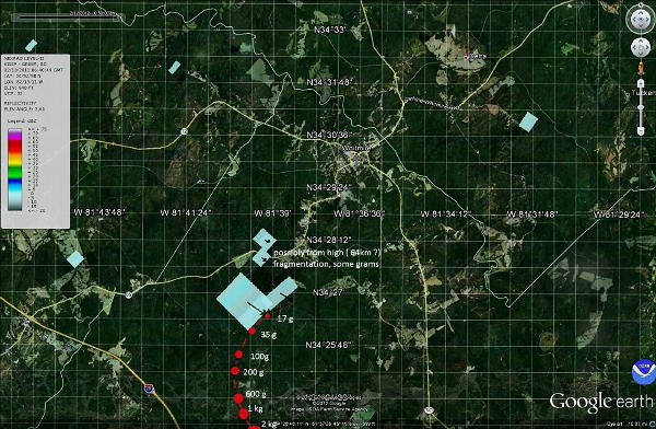
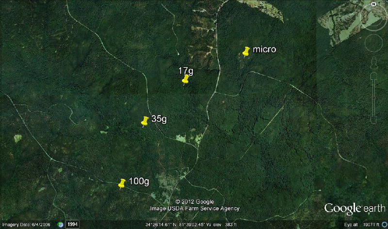
Esko's predicted fall location as it appears on the Dirk Ross website.
(You can click on the above image in order to ENLARGE.)
CLOSE-UP of a portion of Esko's predicted fall location.
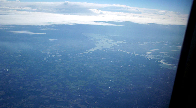
On the flight going back home, I could look back towards the east and see Newberry County,
and where I had spent the last 6 days hiking in the Whitmire area.
I could only hope that those who continue the search will have better luck.
Again, here are the names and email address for the points-of-contacts in Whitmire:
Barry Morris Email: bmorris@newberry.k12.sc.us who is a well-respected Science Teacher at Whitmire Community School
Mike Harmon Email: mharmon@fs.fed.us who is theUSDA Archaeologist at Enoree Ranger Station - Sumter National Forest
Jake Schaefer and his blog titled "SC (2/13/2012 at 6:42 UTC)". (Post to Meteor Observers):
"The data from the seismographs, coupled with the allsky camera [video from Stuart McDaniel],
lead to an estimated trajectory that does point towards those radar hits[from Rob Matson].
They are definitely within the uncertainty/error bounds."
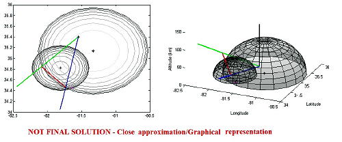
(You can click on the above image in order to ENLARGE.)
http://3dradar.wordpress.com/2012/02/15/sc-2132012-at-642-utc/
Composite Doppler radar image compiled by Rob Matson. (personal communication):
Regarding the image below:
"Yes, this is the radar complex I'm talking about.
It's significant not only due to its size and timing relative to the fall,
but also because of the "candy-striping" in it.
...there is also a lower altitude hit in the very next sweep from Greer
(which is the lowest elevation angle, one file later.) There is also the
hit from the Columbia radar (06:43:03, 2.5-deg cut angle) just a smidge
east of the main hits from Greer, adding confidence that the returns are
all real and not just noise.  --Rob"
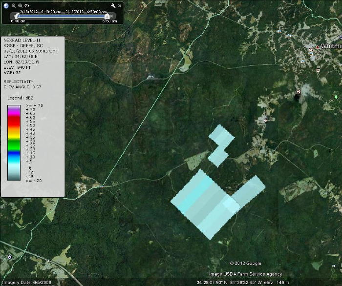
(You can click on the above image in order to ENLARGE.)
https://meteorite-recovery.tripod.com/2012/whitmire/SC_3radar_composite.jpg
Jim Wooddell - on his website "DesertSunBurn". (His post to Meteor Observers):
"To help Rob a little...."
http://k7wfr.us/RobertMatson/Columbia_064303_scan5.kmz
http://k7wfr.us/RobertMatson/Greer_065003_scan1.kmz
http://k7wfr.us/RobertMatson/Greer_064049_scan6.kmz
(You can click on the above links in order to OPEN Google Earth.)
http://lists.meteorobs.org/pipermail/meteorobs/2012-February/014701.html
Stuart McDaniel - on his website "Sandia/NMSU Sentinel All Sky Camera
Network". (As seen on a post to Meteor Observers):
"Congrats to Stuart McDaniel
and the Sandia/NMSU Sentinel All Sky Camera Network
for the nice capture!
Jim Wooddell."
(You can click on the link below in order to OPEN Stuart McDaniel's All Sky Camera video.)
http://skysentinel.nmsu.edu/allsky/viewer/209655
ASC video analysis by Esko Lyytinen. (His post to Meteor Observers):
http://lists.meteorobs.org/pipermail/meteorobs/2012-February/014691.html
and
Flight-path data generated by Esko Lyytinen. (personal communication):
"Hi Bob and all,

I also calibrated the Greensboro security camera video, with the help of
direct contacts with Clark McClure .
( There may still be the posibility to maybe improve this calibration.
Clark also sent me some star images taken with digital camera from the
same site, that are not yet in effective use. The calibration was made by
means of Google maps and also for pixel X/Y ratio, the digital camera
images of the scenery were in use.  ..................................The stars seen
are not very well situated as to the observed track.)
Combining with the video data of Stuart McDaniel from Lawndale,
I get the arrival direction FROM 316 ( 315.7 )
and the "angle below horizontal" 45 ( 45.3) degrees.
Estimated uncertainties in these are
around one degree.
The combining was also fitted (in the same fitting) with the radar
target(s), taking into account dark flight and wind effect simulations.
The entry velocity was derived as 14.0 km/s .
The luminous flight end velocity was derived as about 7 km/s.
The luminous flight beginning height was 89 km and end 26.7 km in
Lawndale camera and 27.1 in Greensboro video.

The resulting modeled strewn field central line can bee seen at
http://lunarmeteoritehunters.blogspot.com/2012/02/breaking-news-mbiq-detects-large-meteor.html
And there you can also see the mentioned Greensboro video.

As it may appear from above, this central line was fitted with the radar
targets. Robert Matson sent me the actual times ( and altitudes) of the
radar scans and a rough estimation of the size of those observed minor
fragments was derived and the wind effect from the radar hit to down
was also taken into account.

Regards,
Esko"
Dirk Ross...Tokyo - on his website "
DesertSunBurn". (His post to Meteor Observers):
From: drtanuki
Sent: Saturday, February 18, 2012 11:43 AM
To: meteorite-list@meteoritecentral.com ; Global Meteor Observing Forum
Subject: [meteorobs] SC projected MetFall Location

Dear List,

Projected fall information from the SC Bolide is now posted:
http://lunarmeteoritehunters.blogspot.com/2012/02/breaking-news-mbiq-detects-large-meteor.html

Thank you to Esko Lyytinen, Finland.  Dirk Ross...Tokyo
(You can click on the link below in order to OPEN the Original Message.)
http://lists.meteorobs.org/pipermail/meteorobs/2012-February/014717.html
As generated by Esko Lyytinen. (personal communication):
"the meteoroid solar system orbit data in the form of Langbroek Excel sheet screen image"
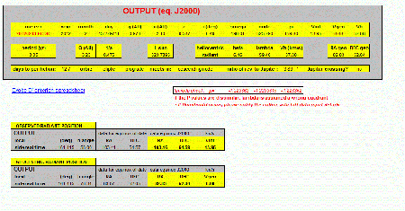
(You can click on the above image in order to ENLARGE.)
https://meteorite-recovery.tripod.com/2012/whitmire/orbit_20120213_064247UT-esko.gif
As supplied to me by Mike Hankey. (personal communication):
"...here are the AMS plots. If you want to contact any of these eye-witnesses, LMK and I can send you their emails."

("Click" on the above symbol in order to SEE IMAGE.)
http://www.amsmeteors.org/fireball2/ams-event-map2.php?year=2012&event_id=228
LINKS:
"ROCKMANSC's photostream" - Michael Johnson's images from the predicted fall location:
http://www.flickr.com/photos/30591991@N04/6782939758/?map=1
"TERA News" - from the Tyger-Enoree River Alliance - Jon Durham (TERA Riverkeeper)
http://www.tygerenoree.com/News/news.html
"New Video Shows Upstate Meteor" - by: WSPA Staff | WSPA-TV7 SPARTANBURG, S.C.
With 27 comments!
http://www2.wspa.com/news/2012/feb/14/big-boom-monday-morning-may-be-meteorite-officials-ar-3220118/
"UFO Explodes Over South Carolina? 2012" - from one of your typical UFO websites:
http://www.2012honduras.com/2012/02/15/ufo-explodes-over-south-carolina-2012/
For for more information, please contact me by email:
Bolide*chaser
